the tokyo files archives 東京ファイル
Here’s the Nomikawa 呑川 river in 1948. There are two branches: the lower branch, a horizontal line facing east/west, is labelled “Nomikawa Canal”.
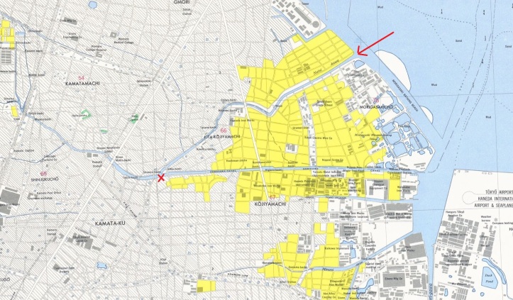
The upper branch, which appears to say “Noini -kawa”, is the original Nomi-kawa. Sometime after 1948, the upper branch of the river was fully diverted and is now covered by walking paths, roads, Kyunomikawa Ryokuchi Park, etc. A school, Tōho Junior High School, is built on land that was once the split between the river and the canal. See map.
Like many former rivers in Tokyo, an abundance of trees takes the place of water, which makes for a pleasant walk for much of the approximately 2-kilometer former river.
What was once the canal (the lower branch), is now considered the Nomikawa river.

Years ago, I crossed the old river late at night as I was walking to Haneda Airport. I could tell something was unusual about this place, but I didn’t…
View original post 47 more words
